Liz Thornhill, Head of Research Programme at Future Observatory, interviews Flora Samuel, Scott Orford and Alec Shepley from Public Map Platform, one of our Green Transition Ecosystem projects.
LT
Can you please introduce yourselves, your organisations and your role within them?
FS
I'm Flora Samuel, a Professor of Architecture and Head of Department at Cambridge University. I'm also principal investigator on Public Map Platform. I oversee the project and look after engagement.
AS
I'm Alec Shepley. I’m a Professor of Arts and Society at Wrexham University and the Associate Dean for research. I'm a Co investigator on the Public Map Platform project and my area of responsibility is the cultural mapping layer. I manage the deployment of Welsh bards onto the island of Anglesey to see if storytelling could play a part in the green transition.
SO
And I'm Scott Orford. I'm a Professor of Geography and Planning at Cardiff University and I lead on the build of the platform; I'm the person who's trying to make sense of the data and bring it all together.
LT
Can you tell us a little bit about Public Map Platform and how it fits within Future Observatory and AHRC’s Green Transition Ecosystems?
FS
The essence of the project is to build a deep data map of Ynys Môn (the Isle of Anglesey) taking all sorts of published, organisational data and overlaying that with community data, with a focus on data coming from children and young people as a basis for helping to support green transition behaviours. In order to do this, we're doing a lot of engagement work, which is working with deep conversations on the local culture and thinking about the green transition. I think that technological ways of working have not really managed to make sustainability happen, whereas I think sustainability is very much a cultural and social endeavour. The pilot of Public Map Platform is based on Ynys Môn, but we are spreading out to other places in phase two and the aim is to change the nature of the planning system so that it becomes much more inclusive.
SO
We chose mapping because it is part of the lexicon of planning and it's the language of place and space, so if you want to engage with planners and spatial practitioners, mapping is the natural way in. Also, people understand maps and we find they are excellent rhetorical devices which allow young people to talk about place, and those discussions are as important as the map itself.
AS
The engagement piece has been the most exciting and rewarding part of the project for me. We talk a lot about participation and co-creation, to gather emotional, sensory and imaginative information. Which is why Welsh bards are included in our project, in the hope that they might unlock what conventional approaches may not capture.
LT
How does the Public Map Platform project support the green transition?
FS
As we go forward and expand the project, we’d like to help local authority planners make better use of resources, and Scott's team will be developing a service which enables councils to see where pollution is happening, where biodiversity is being depleted, where poor decisions are being made. I have a favourite overlay in Scott's beta map, which shows ammonia levels in Wales, which has allowed us to see where villages being effected by heightened levels of ammonia could benefit from tree planting to help reduce this level.
At the same time, Alec is working with young farmers and the North Wales Wildlife Trust to encourage using these data maps for land use: Welsh farmers must use 10% of land for rewilding, but there are no stipulations for where that happens, but if they use the Public Map Platform to collaborate with other farmers, they could make sure that 10% rewilding was actually producing a wildlife corridor that would actually help nature thrive. So you see, choreographed information can lead to better decision making and we're trying to help local groups collect evidence so that green transition solutions can be found.
SO
Well, another project within Public Map Platform was around air pollution. We got school children to wear air pollution monitors on their backpacks to measure the level of pollution they were exposed to on the journey to and from school, at school and at home. This sort of research has been done a lot in urban areas and the emphasis is on the school journey because of traffic on main roads. But what we found was something quite different: their journey to school wasn't so bad, but a lot of the children live in houses which have solid fuel and this is where pollution readings were high, so it raised the issue of housing stock on the island. But it allowed children and parents to have interesting conversations around fuel and green transition issues like heat pumps.


LT
Can you tell us how and why you work with local partners?
AS
Rather than an individual partner, we see the project as having a cradle or a basket of partners and one of the main groups is the local schools and another are the young farmers. But the initial engagement is the hardest part of a collaborative project – it’s hard to reach those seldom heard voices. So coordinators communicated with lots of individuals to gather as many voices as we could.
One particular community was Llangoed on the Eastern side of Anglesey north of Beaumaris, where children and young people worked with one of the bards called Lisa Hudson to map play, mobility and bus routes. We also distributed looms across the island, to create happenings, which in some case became major happenings (as many as 400 school children in Newborough last summer) which gives others a chance to get involved by creating a spectacle. That event came about via Anglesey Council and was sponsored by Adverse Childhood Experience Aces Hub Wales.
FS
We have a Wales advisory group and we have an England based advisory group and they're incredible people who are helping the project. We also work with the Future Generations Commissioner and the Welsh Government, because we want to make sure our maps are useful and are responding to the Welsh Future Generations Act 2015. And we've gathered partners along the way, such as Public Health Wales, who funded our event in Newburgh because they're interested in the in the well-being aspect for children and young people.


LT
It’s incredible to hear what has happened in phase one. How is the project progressing, and what is going to happen in your second stage of funding?
FS
In phase two, we are expanding. We'll still be mapping the island, and making a really deep data map, because we want to show how good it can get. But we are also joining up this work with places in England, other mapping epicentres, and working within the concept of the Urban Room to talk about planning – so Alec is working in Wrexham and Scott is working in Pontypridd, but other areas where people are asking us to get involved, such as Eryri National Park, formerly known as Snowdonia.
We're developing training materials, so that more mapping work can be done remotely and we're also in the process of entering our mapping activities into the Welsh Baccalaureate; so Welsh children will use digital mapping as part of their education, which expands the map’s data points and the communities’ ability to map. We're also developing a service that helps local councils to plan and develop in a much more efficient and map-based way, without external, expensive consultancies.

LT
You’ve already mentioned a few legacy projects within phase two, but what are some other long-term outcomes of the Public Map Platform project? What are you are hoping to achieve by 2028?
AS
The people within the maps and the mappers themselves are the legacy of the project. The beauty of maps is that there's a there's a map for you, you can map anything, and once you’ve been trained as one of our mappers and know how to use the technology, you’re able to train others.
SO
What’s great about the project is that it is all co-produced. The reason we've been successful is because it's not been top down, we've got into communities and built from the bottom up. We've deliberately put money into the mappers and not the software engineers because it was no use building a platform with no data.
FS
I agree. Ultimately, it's about democracy and the sensation of being able to have impact and have your voice heard. With Scott's maps, if you home right in, you can see where an individual has inputted a piece of data, and that's a very empowering thing. I just read economist Dieter Helm’s book, Green and Prosperous Land, and it's all about systemic change and coordination and really that's what Public Map Platform is all about: people working together to make better use of resources and sharing risk as climate change really starts to take hold. So, I hope that more public bodies will embrace the map and it can become a bigger tool, potentially within Welsh Government or English government.
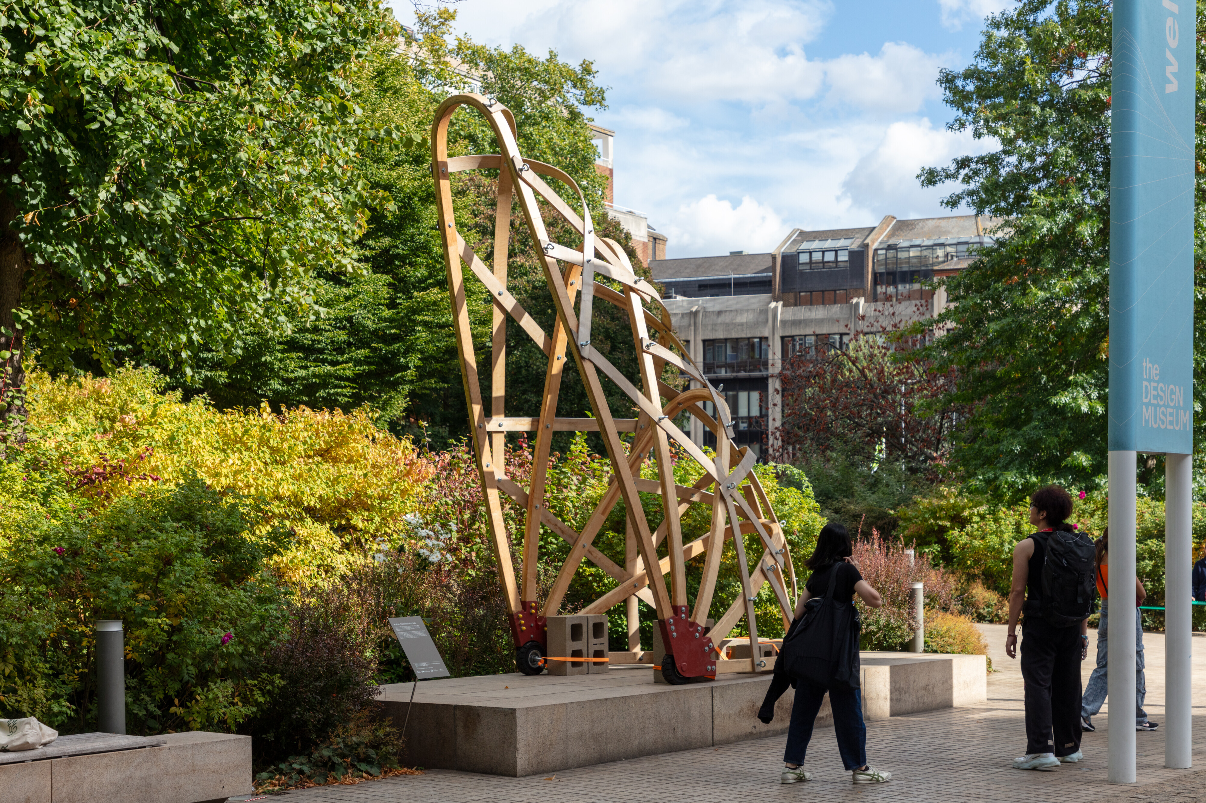
Tools for Transition will be on display in the Design Museum’s second floor until August 2026.